Munin Space Technology is a Spanish Agri-tech start-up that uses satellite-connected Internet of Things (IoT) sensors and satellite imaging to enable making more informed decisions, find anomalies on farms and in orchards, and control them from a distance.
Jorge Iglesias García, the Founder and CEO of the company: “We are helping growers do more with less by enabling them to very accurately keep track of what is happening in their orchards. We believe agriculture is at a tipping point: inputs are becoming more expensive, and with the effect of climate change, these effects will only multiply. Having data helps to be more exact with resources, less waste, and better utilization of input. Having data is the only way to help them move forward.”
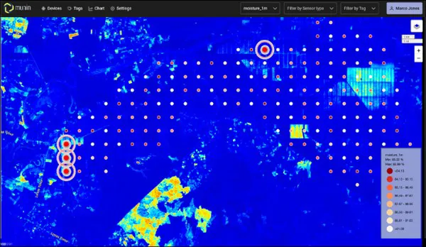
“Our platform solutions combine soil sensors with proprietary IoT and satellite imagery. We are currently in the process of developing more sensors that can be used to understand if the fruit is mature, monitor growth on the farms, and keep track of the season. The data that we collect and other data from the orchard is combined on one platform, our own APP, so growers have everything in one place”, says Jorge.
“My co-founder and I both come from NorthWest Spain, which is an agriculture region. Our background is in engineering, and I worked for the European Space Agency (ESA) for seven years before relocating to Singapore. For ESA, I was involved in the creation and launch of the Sentinel-2 satellite mission, which has several different agriculture applications. This is how I became familiar with this technology. When I moved to Singapore, I started to work in the AI industry and saw the potential it has to help agriculture. Originally, we were looking for IoT connectivity for all kinds of devices. Then we decided to settle on agriculture-related solutions, as this market will witness a substantial change in the future and face several challenges, among which climate change,” explains Jorge.
The founders realized that in the agriculture industry, there is not a lot of data gathering infrastructure yet. The company’s innovation lies in the collecting of different types of data and bringing them together in one place. For the growers, it’s a ‘plug and play’ solution, meaning that after the APP and the sensors are installed, the program will run, and it will produce meaningful recommendations for growers.
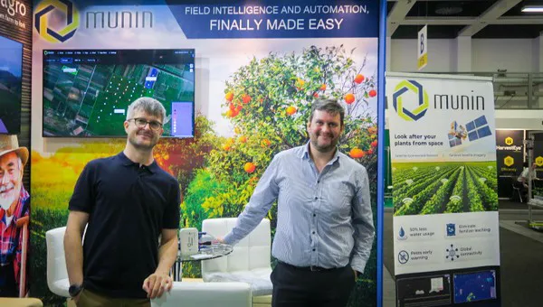
Jorge, right, together with this partner Diego Rendoiro Rodriguez
Jorge continues: “Our customers know how to grow produce and how their orchards and production works. We know the technology. When we engage with new clients, we usually start with a few devices, like 5 to 10 on a trial plot of land. We also grant them access to the platform. Then they have access to the data and will receive alerts when something is wrong and periodical reports to be used in-field. We aim to offer our solutions at affordable prices to be accessible to the industry in different countries. Our devices can be purchased for between 300 and 400 USD, and access to our platform and APP is around 100 USD a year. We also give recommendations to growers and additional advice at an additional cost.”
“Our affordable pricing structure enables us to work with smaller companies, like blueberry producers, with farms, for example, under 20 hectares. Our data is important to keep plants as healthy as possible during the growing stage. We measure, among others, water content and electrical connectivity to estimate the amount of nutritious content. We are adding sensors for acidity, PH, and fruit and leave colors. From our satellite imaging, we can measure general things about the orchards like plant stress, water stress, or pest hot spots. For example, our data can avoid that growers have to spray a full orchard with pesticides – with the right information, they know exactly where in the orchard to apply pesticides,” Jorge concludes: “We can help growers to achieve better results with less inputs.”
For more information:
Jorge Iglesias García
Founder & CEO
Munin Space
www.munin.space
[email protected]